
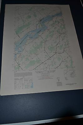
1940's Army (like USGS) topo map Sparrowhawk Point NY ONT St Lawrence 5973IVSE - $30 - (Slingerlands, NY)
Back to Search Results
Posted 1 month ago
This is an Army Map Service map of Sparrowhawk Point from the 1940's showing the Saint Lawrence River from Round Island to east of Whitehouse Creek Twin Island including the Galop Canal and Iroquois Ont. This was developed as part of the war effort and was distributed to libraries after the war. This map is suitable for framing and guaranteed original. 22x29 1:25,000 Shipping is for US addresses and I will combine shipping. Shipping is done in a sturdy mailing tube. If you would like combined shipping, contact me prior to bidding. This auction is for the first of two I will be selling.
ADVERTISEMENT
From ebay.com - 1 month ago