
1940's Army topographic map Hebron Virginia -Sheet 5458 III NE - $20 - (Slingerlands, NY)
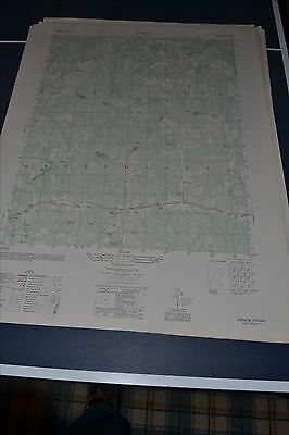
This is an Army Map Service map (AMS V834) of Hebron (printed 1948-50) showing Wilson, Ammon, and Liberty Church. The intersection of Amelia, Nottoway and Diniwiddie Counties is in the center of the map. This was developed by the military as part of the effort associated with World War II and was distributed to select libraries after the war. This map is suitable for framing and guaranteed original. 22x29 1:25,000 Shipping is for US addresses and I will combine shipping. These maps have been stored flat since printing and will be shipped in a sturdy shipping tube. Look for my other similar maps of the area. If you would like combined shipping, contact me prior to bidding. This sale is for the first of two copies of this map.
ADVERTISEMENT
From ebay.com - 1 month ago