
1940's Army map Rushing Kentucky -Sheet 3357 II NE Murray - $20 - (Slingerlands, NY)
Back to Search Results
Posted 1 month ago
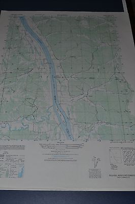
This is an Army Map Service map (AMS V853) of Rushing (printed 1948) showing what is now Murray and Land Between the Lakes. This shows the Tennessee River before it was dammed and locations of old family cemeteries. This map is suitable for framing and guaranteed original. 22x29 1:25,000 Shipping is for US addresses and I will combine shipping. These maps have been stored flat since printing and will be shipped in a sturdy shipping tube. Look for my other similar maps of the area. I will combine shipping if you buy multiple maps. This sale is for my only copy of this map.
ADVERTISEMENT
From ebay.com - 1 month ago