
1940's Army topo map Henry South Carolina -Sheet 5151 III NW - $20 - (Slingerlands, NY)
Back to Search Results
Posted 1 month ago
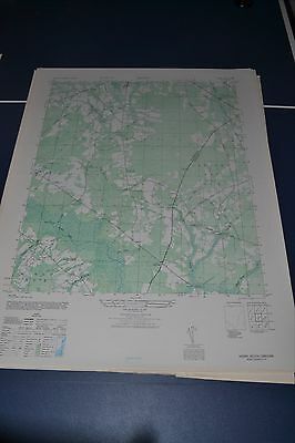
This is an Army Map Service map (AMS V846) of Henry (printed 1949) showing Hemingway, Brunson Crossroads, Poplar Hill, Gordonville, Owens, Hopewell and Union Crossroads. nbsp; This was developed by the military as part of the effort associated with World War II and was distributed to select libraries after the war. This map is suitable for framing and guaranteed original. 22x29 1:25,000 Shipping is for US addresses and I will combine shipping. These maps have been stored flat since printing and will be shipped in a sturdy shipping tube. Look for my other similar maps of the area. If you would like combined shipping, contact me prior to bidding. This sale is for my only copy of this map.
ADVERTISEMENT
From ebay.com - 1 month ago