
1940's Army map Mount Pittsburg Colorado Sheet 5061 III SW - $25 - (Slingerlands, NY)
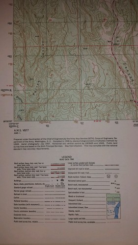
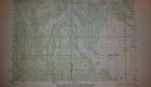
This is an Army Map Service map (AMS V877) of Mount Pittsburg Colorado (printed 1949 based on 1947 aerial photography). The map is bisected by the Fremont - El Paso County Line and shows part of Pueblo County in the lower right corner. Red Creek, Pinehurst, Fords Mountainside and Turkey Creek Ranches are shown. nbsp; This was developed by the Army Map Service and was distributed to select libraries after the war. This map is suitable for framing and guaranteed original. 22x29 1:25,000 Shipping is for US addresses and I will combine shipping. These maps have been stored flat since printing and will be shipped in a sturdy shipping tube. Look for my other similar maps of the area. If you would like combined shipping, contact me prior to bidding. This sale is for my only copy of this map.


ADVERTISEMENT
From ebay.com - 1 month ago