
1940's Army topo map Bordley Kentucky -Sheet 3459 III SE - $40 - (Slingerlands, NY)
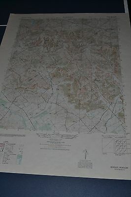
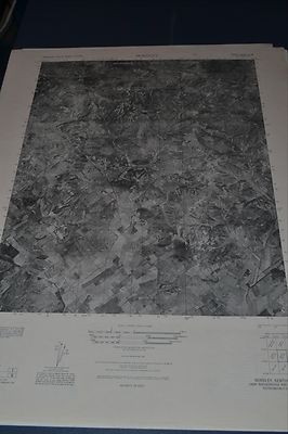
This is an Army Map Service map (AMS V853) of Bordley (printed 1949, using aerial photography from 1946) showing Williams, Hearin, Shelton and north to the border of Camp Beckinridge. The reverse of this map is a full size B&W photograph of the same area. nbsp; This was developed by the military as part of the effort associated with World War II and was distributed to select libraries after the war. This map is suitable for framing and guaranteed original. 22x29 1:50,000 Shipping is for US addresses and I will combine shipping. These maps have been stored flat since printing and will be shipped in a sturdy shipping tube. Look for my other similar maps of the area. I will combine shipping if you buy multiple maps. This sale is for my only copy of this map.These maps are 1:25,000, not 1:50 as previously noted.
ADVERTISEMENT
From ebay.com - 1 month ago