
BRITISH ISLES, BRITAIN, UK, Van Den Keere, Cluver, Jansson, antique map 1661 - $165 - (Shrewsbury, ENG)
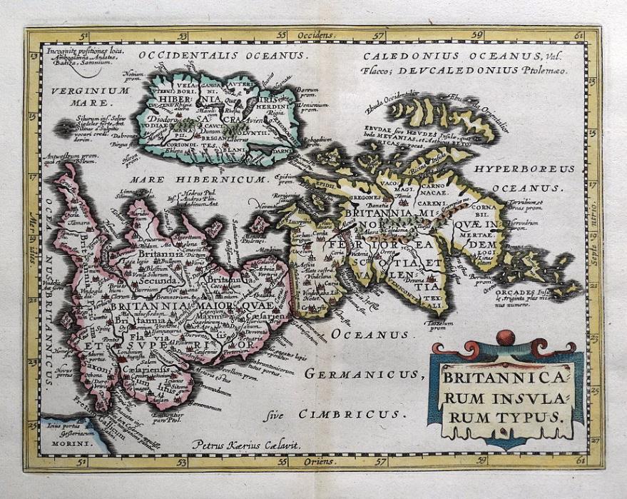
BRITANNICARUM INSULARUM TYPUSby Pieter Van Den Keere Published by Johannes Janssonium, Amsterdam 1661 in Philipp Cluver's "Introductionis in Universam Geographiam, Tam Veterem Quam Novam Libri VI ." An original 17th century copper engraved miniature antique map of the British Isles with north orientated to the right.. An excellent example on robust hand laid paper, blank verso. Enhanced with attractive later hand colouring. Fine, clean condition. Free of repairs or restoration. Centre fold as issued. Approx. 8" x 6" (200mm x 155mm) map area only, with full margins beyond. A scarce map. Philipp Cluver (1580 -1622) was an early German geographer and historian who published a number of works on the antiquities of Germany, Sicily, and the Rhine valley.He went on to produce a number of miniature atlases including the Introductionis in Universam Geographiam which was published after his death from 1624 onwards.This example is from Jansson's edition of 1661. The maps were engraved by several leading cartographers of the time, predominantly by Pieter Van Den Keere, and others by Abraham Goos and Abraham Ortelius. A GENUINE ANTIQUE MAP GUARANTEED OVER 350 YEARS OLD FROM LINDISFARNE PRINTSTGG818We do not deal in reproductions, facsimiles or modern copies of any kind. FREE UK SHIPPING. INTERNATIONAL SHIPPING Two items are combined and three items sent by standard shipping free of charge world-wide.

ADVERTISEMENT
From ebay.com - 1 month ago